The 1946 Windsor F4
On June 17th, 1946, one of the deadliest tornadoes in Canadian history touched down. It would touch down in Michigan, across the border, dealing relatively weak damage while in there, before crossing the Detroit River and into what is now LaSalle, and then ending near Tecumseh on Lake St. Clair. This is one of the lesser-known F4's, mostly due to it touching down in the 1940's, and it being a Canadian tornado. In fact, we almost didnt even know most of the information about it, since many of the records were lost or destroyed, specifically newspaper's, which is where we get alot of information from older, pre-1970's tornadoes, where we decided it was a good thing to write down and record information about tornadoes.
A brief Description
This F4 touched down in the melvindale neighbourhood in Detroit, and tracked ENE. During its time in Michigan, it did minor damage and was rather uneventful, Although notably, it passed right over Zug Island and the Rouge River. However, once it crossed the Detroit River, it became much more infamous. It started to shrink and intensify, somewhat similiar to the Elie F5, Canada's strongest-rated tornado. More on the path later. The tornado impacted the windsor area hard, with the death toll between 15 to over 20 people. The death toll is high debated, as the records and reports range greatly, but semi-officially, the death toll is 17, which makes it the 3rd deadliest tornado in Canadian history, and the deadliest in Ontario. Many were also injured, with over 100 reports, and around 20 seriously injured. This F4 was also investigated by Environment Canada to see if could be upgraded to an F5 rating, but they later concluded that there was not enough evidence.
Nothing is really known about the environment that that, besides for a few charts on the low pressure systems and other surface-based readings. But from what I can presume (well guess) is that it was classic high-cape low shear event. According to interviews with people, it was a sunny and hot day, and there was few clouds in the sky.
The Path
 The path of this F4 is also somewhat unique. As when it formed it was moving SE and was wide and weak. When it crossed the detroit river, it started to tighten in width, and then it took a ENE turn, into the city of Windsor. It would jog along that direction, narrowly avoiding the Windsor Airport, and continue into the town of Tecumseh, where it would then go over Lake St. Clair, where it would lift over the water. Over the Tornado's life-span, the damage path was narrow, due to the tornado being a rope/stovepipe tornado. This is why the damage was so intense along the path, as violent, thin tornadoes have a strong upward "lifting" motion, which helps them pickup/lift debris much easier. A good example of this would be the Elie Manitoba F5.
The Damages
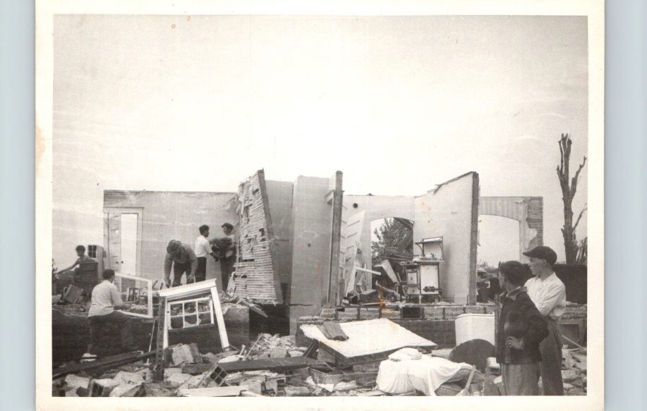
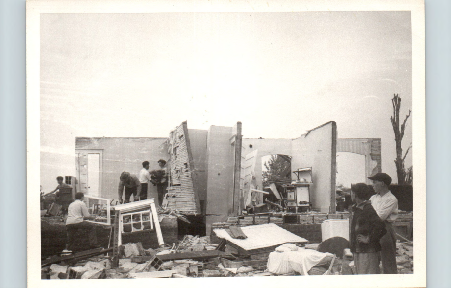
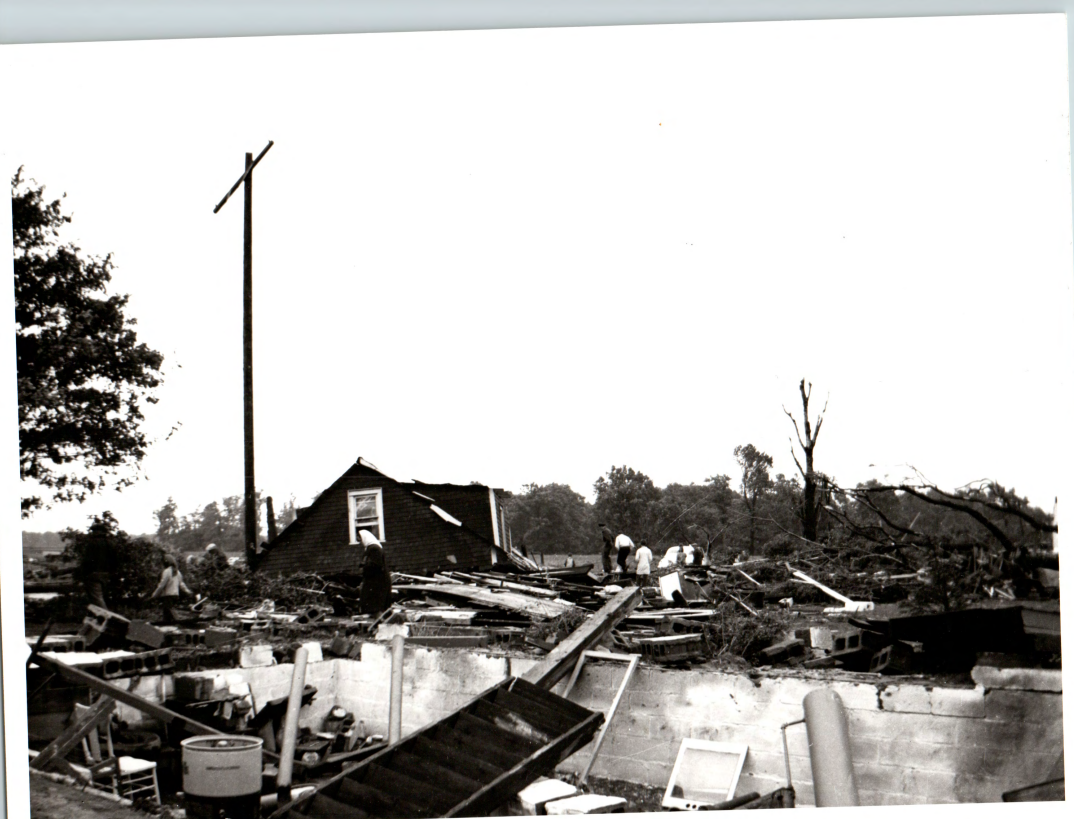
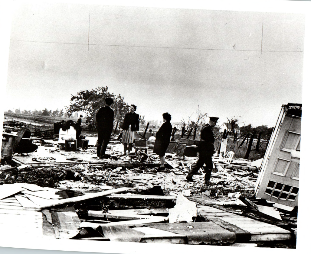
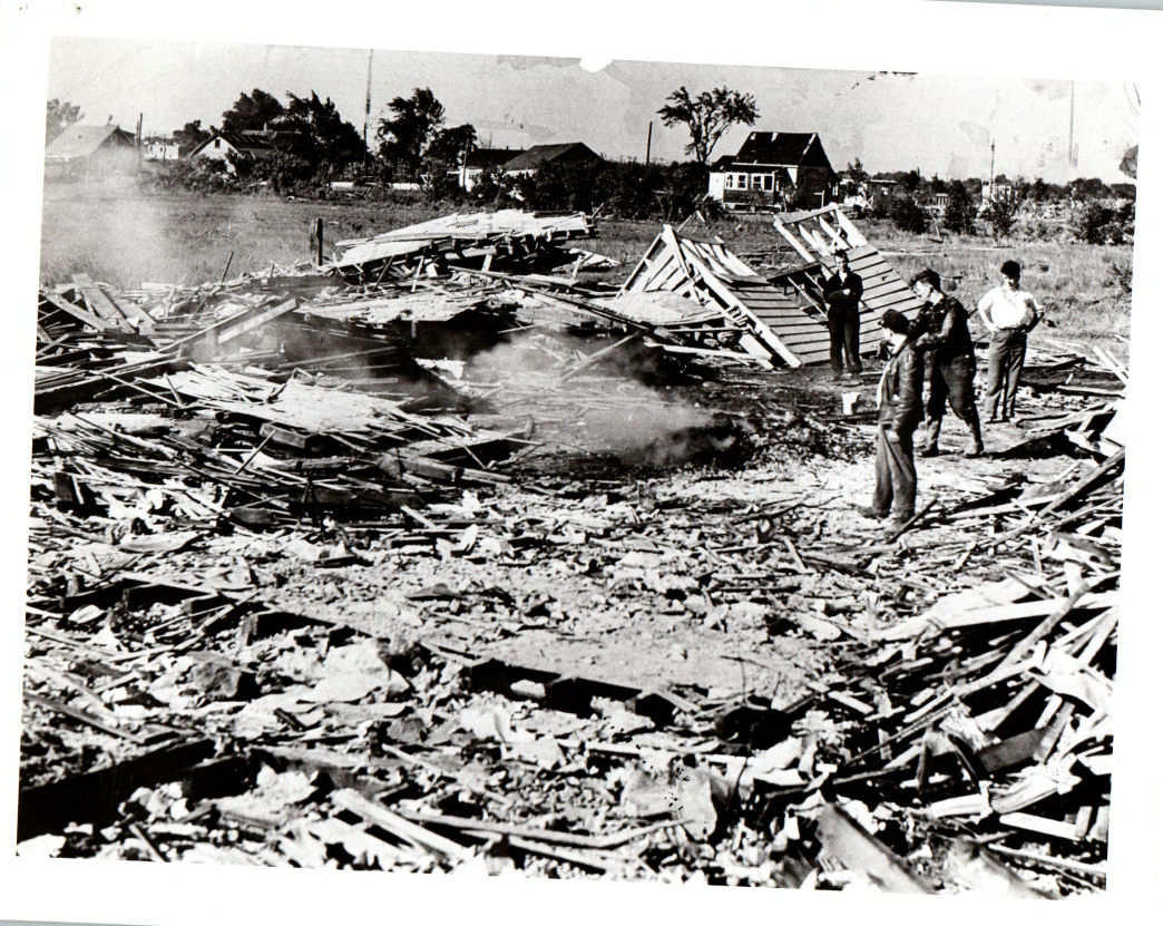
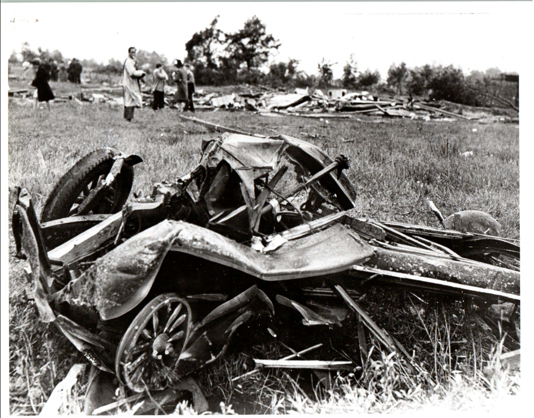
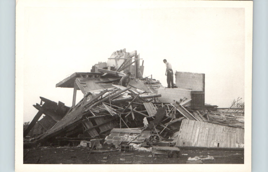
 One of the most memorable part of this tornado is the damage. The damage inflicted was something else, and was even looked at to see if it inflicted F5 damage, which Environment Canada would say that there was a lack of evidence and kept the F4 rating, as stated earlier. The overall damage path was a narrow, slightly bendy line, where the gradient was intense. One house would stand perfectly fine, and then the neighbours land would look like there was never a house there to begin with. As the tornado was on the ground, a pilot in the air, Ray Milner, watched from the cockpit as the tornado ripped through Windsor. He would describe the damage as "the tornado crumpling the buildings like eggshells, and it would pick up objects and while them around". On the topic of planes, The tornado actually picked up an airplane in detroit and carry it across the border, where the plane would land on a house, killing the residents inside of the house. The plane was flying in the air, near the tornado, where it then got "disintegrated" by the tornado and fell/crashed near the Chrysler Plant
 Planes weren't the only thing that got lifted by the tornado, objects would be found quite the distance away from where they came from, as a pair of pants was found in Belle River, which had belonged to Waldo Beeman, found through the items in the pockets. Unfortunately, Waldo and his fiancee and child were killed by the tornado. In another case, Sheet metal was found all the way in Tilbury, from the tornado. Books were also found in Tilbury, taken from the homes in Windsor. Even in my hometown of Comber, some "debris" had fallen, a two-seater aircraft bound for detroit had crash landed in a farmers field just outside of town, and some actual debris, aluminum sheets, had also made its way on this farm. Planes apparently were also mistaken as debris in the air, and the same for debris being mistaken for planes. Some debris even flew the distances as if it were a plane, with debris being found in Blenheim and Merlin. The furthest piece of debris that was lofted was a piece of roofing, which landed in Port Alma, which is further than half the distance of Lake Erie from the west side of it, to the east.
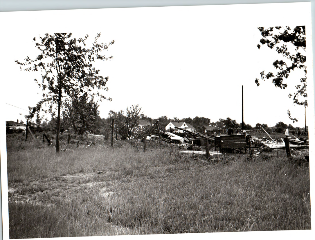
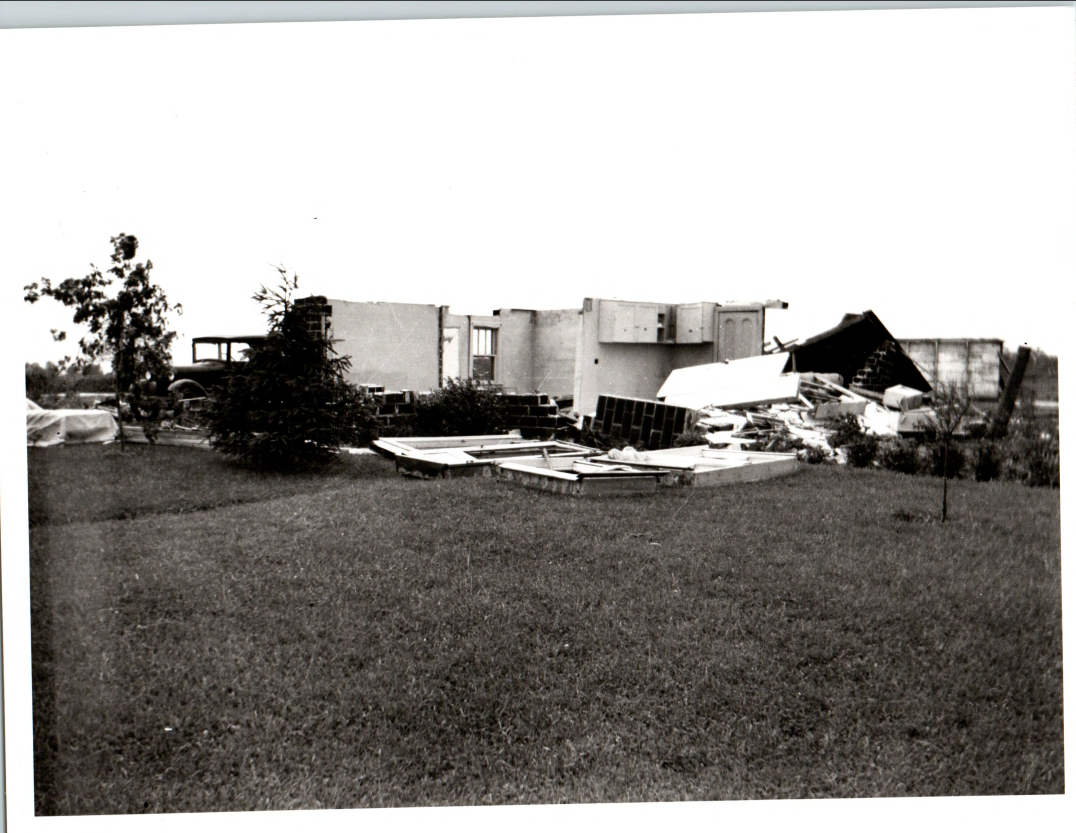
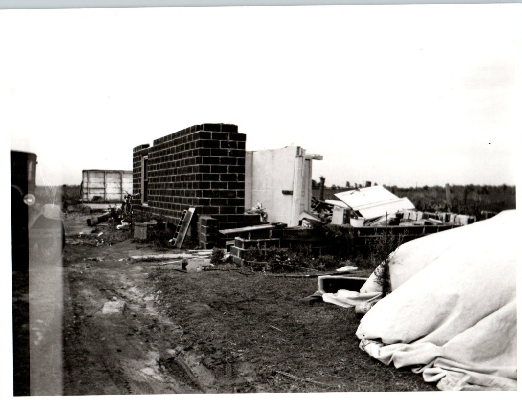
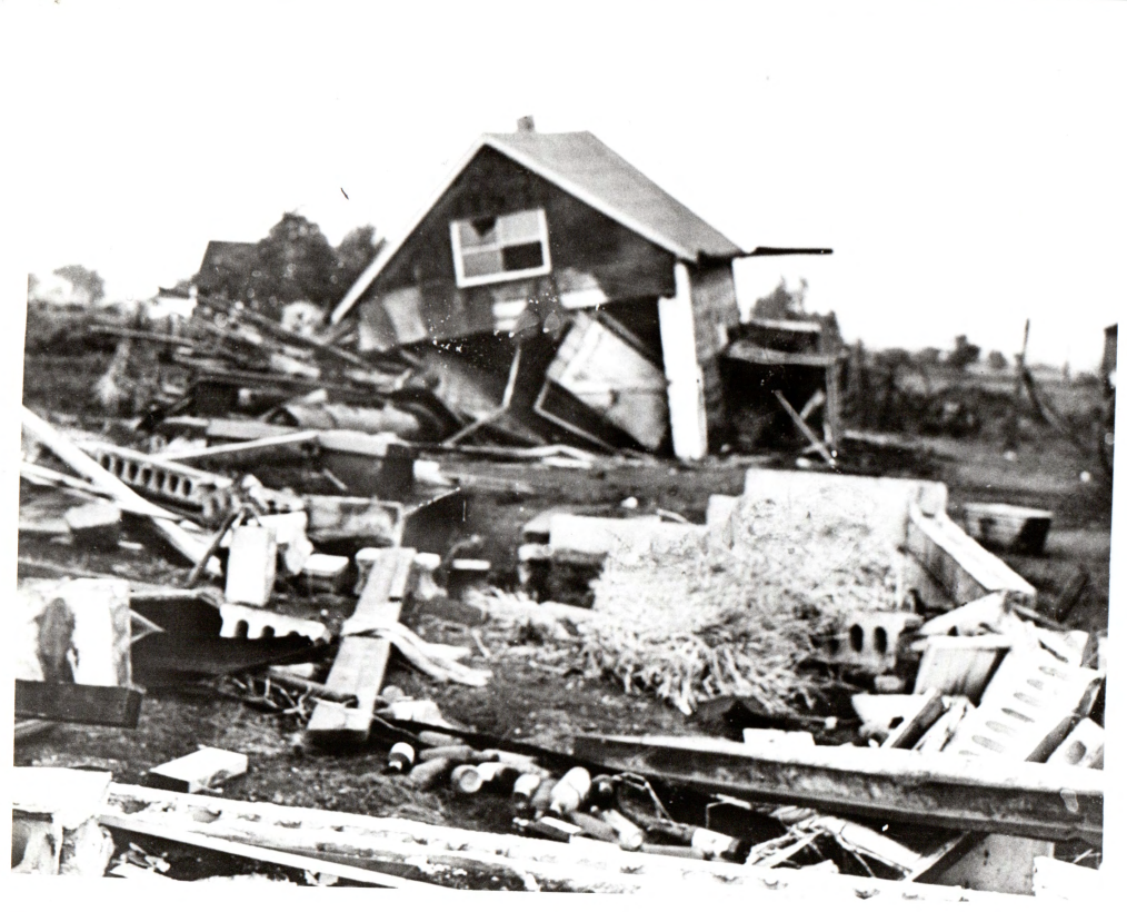
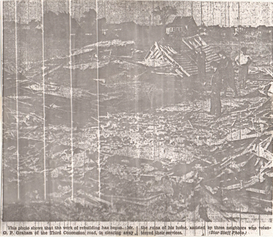 As for the houses, some would be lifted completely off their foundations, and in one case, the tornado shifted an entire house from its foundation, where the family who was running into the basement would be. One of the members got caught between the foundation and the house. The damage to houses in the area is quite intense, with houses being reduced to nothing but parts of a foundation, and unconfirmed damage to some foundations of houses (I have heard around from people that apparently the tornado cracked foundations, but havent seen anything to confirm it). Most houses that were impacted were either clipped by the tornado, splitting the house down the middle, making them look like a dollhouse, or were directly impacted by the tornado and completely flattened. There were also cases where entire houses were picked up in one piece and then thrown and disintegrated. In some cases, entire neighbourhoods were completely gone, and entire families were left dead.
The following is a collection of some damage photos from several newspapers, has all the photos of damage that wasnt shown on this page
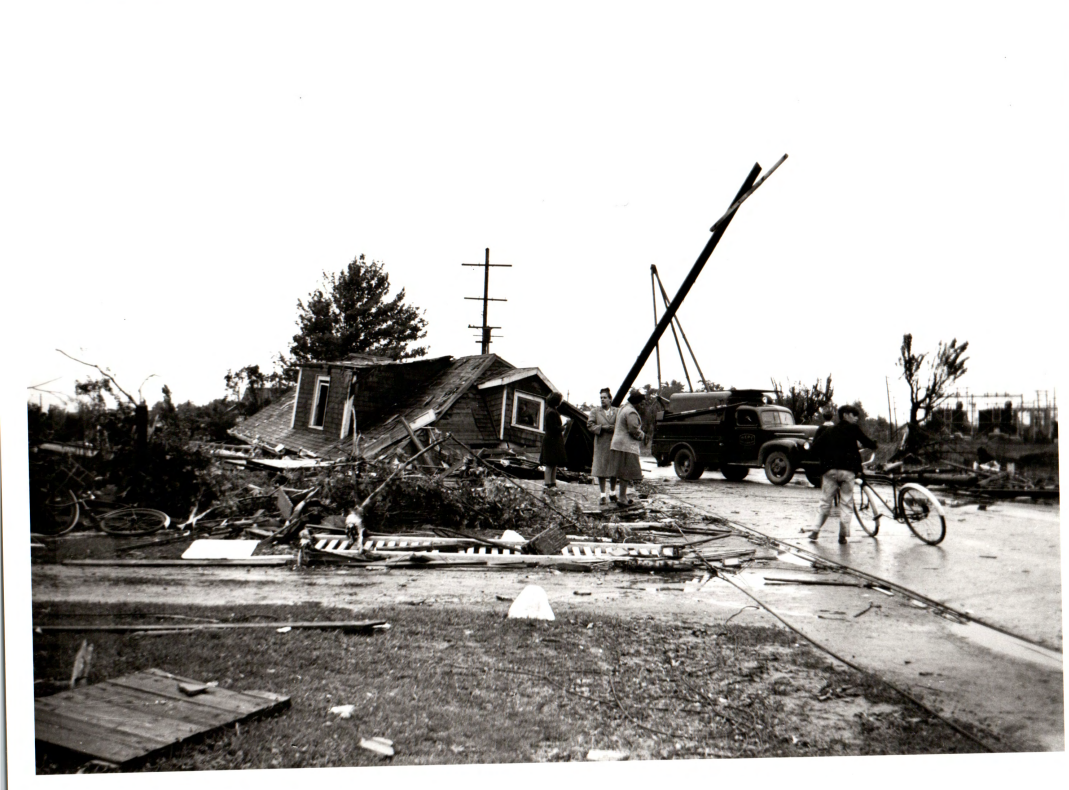
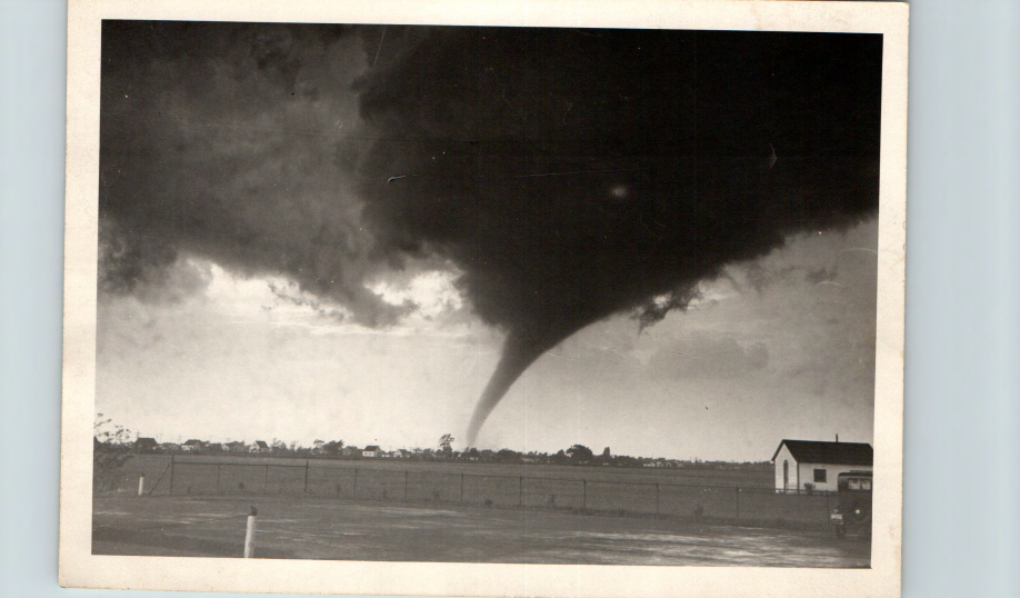 The Windsor Airport also nearly got struck. One of the more "famous" photos of this tornado come from the airport, the photo to the left. I believe it was taken on the North Western side of the airport, looking over Walker Rd, facing East. There are also other photos taken at/near the same spot, taken later on in its life, where youre looking more towards the north as the tornado went over Walkerville.
In addition to all the damage, major flooding was also an issue. In many places, 2 feet of water was found. Flooding could be seen from Tilbury/Comber to all the way to Erieau, where some of the levee's got washed away, causing more flooding.
The Legacy
 This Tornado would be known as the third deadliest tornado in Canadian history, only coming in behind the 2nd deadliest, the Edmonton F4 in 1987, and the deadliest, the Regina F4 in 1912. This tornado would kill ~17 people, potentially more or less as the death toll is really vague. In my research, I've seen the count as low as 15 (although this could have been from right after the tornado) and a count as high as 20 deaths, but officially, the death toll is at 17, atleast on the archive. This number is usually the one that most organizations/people use as.
This tornado also put alot of fear into the people, mostly from tornadoes. Both before and after, even mentioning the word tornado, or cyclone for that matter, was banned in Canada and the United states. This woul dlater be relaxed though.
Other Information
This is not the only strong tornado to hit this area, as an F3 hit a very similiar part, and had a very similiar path, to the F4. This F3 was a part of the 1974 Superoutbreak and has its own controversies, mostly on the damage it did while in Canada, and if it actually deserved the F3 rating it recieved.
Most of my information came from the Michael Newark Archive. This archive has pretty much all the significant tornadoes that impacted canada from the 1940's until about the 1990's. It was made by Michael Newark, who was one of the lead meteorologists for Environment Canada for the later half of the 20th century. This is pretty much the only archive that has information on the Windsor F4, and is a great resource on some of the older tornadoes in Canadian history (which I probably will use in the future). This Archive is also where I got many of the photos from, especially of the damage. From what I could find, pretty much every single photo came from newspapers. Mostly from the Windsor Star (which fun fact, couldnt print the paper for atleast the next morning due to power outages, so one in detroit helped out), One in Toronto, and one from the Brampton area.
There was also a documentary made on it in the early 2000's, from a docuseries called Disasters Of The Century, Season 3, Episode 49 is the documentary on the F4. From what I can remember, the documentary was decent, well it was a classic early 2000's low-budget documentary. From what I remember, the information was spot on, and its where I found out about that house being shifted, pinning the father. It does have a bit of dramatization, and a god-awful map at 3:45 of "tornado alley". This map was so bad its basically the only thing I remember vividly, I have no clue how they put it in. It has Detroit/Windsor above the thumb of Michigan, and for some reason Wisconsin sank into Lake Michigan. I can only assume the software they were using had a bug in it, or user error.
Personal Notes
I personally believe that this tornado is often forgotten, as most people dont even realise that this tornado had happened, probably due to how old this tornado is, and since there is very little information on it, mostly just newspaper clips, and maybe the odd radio broadcast. Its also one of my favourites. Its weird to say that, saying a deadly force of nature, that killed and ruined lives is my favourite, perhaps its not the right word to describe it. I guess attachment would better describe what I feel towards this event. Its local history for me, and I honestly believe its one of the most important tornadoes in canadian history.